From laser-physics research to field instruments

Timeline

Three periods in the instrument line

Research foundations, field use, and the development of a French instrument company

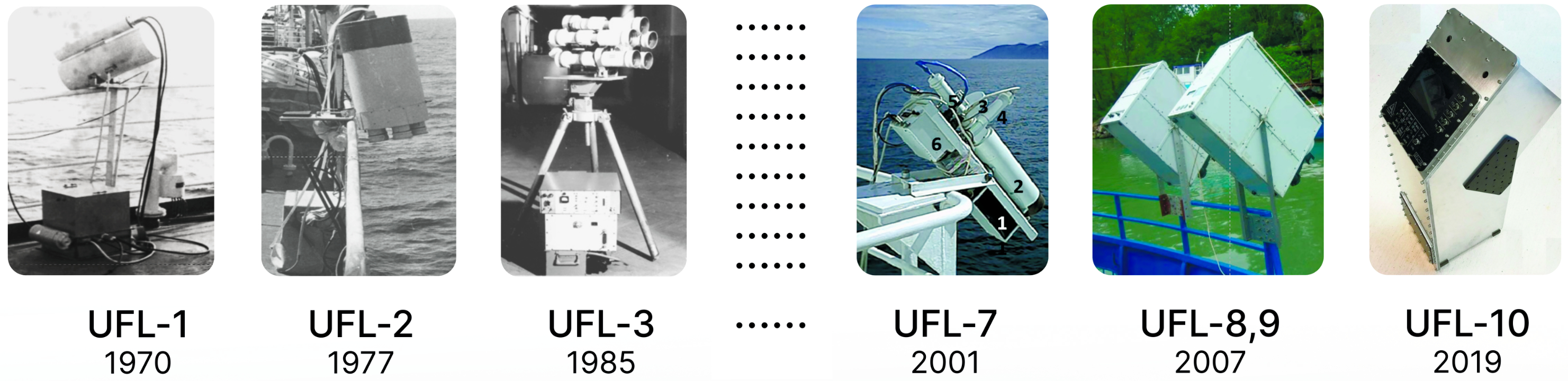
Progression of the UFL instrument line: UFL-1 (1970), UFL-2 (1977), UFL-3 (1985), UFL-7 (2001), UFL-8 and UFL-9 (2007), and UFL-10 (2019)
The UFL instrument line, 1970–2019, from the LIFeLiDAR historical archive
1970s–2000s

Research foundations in laser remote sensing

The instrument line draws on several decades of work in multi-wavelength laser-induced fluorescence across academic optics and ocean-physics laboratories. That work established water Raman scattering as an internal reference and developed spectral methods for identifying and quantifying constituents in natural waters.

  • Multi-wavelength excitation
  • Raman-referenced retrieval
  • Bio-optical algorithms
2003–2022

Two decades of expedition fieldwork

LIF lidar measurements were collected at more than 50 water sites, including the Black Sea, the Caspian, the Kara Sea, Patos Lagoon, Issyk-Kul, the Volga, Gorky Reservoir, and Lake Balaton. A peer-reviewed UFL water-quality paper appeared in 2013, followed by work using Sentinel-2 and Sentinel-3 data.

  • 50+ water sites
  • First UFL paper, 2013
  • Sentinel-2 / -3 cal/val
2022–present

Founding of LIFeLiDAR SAS

The LIFeLiDAR project received DRIEETS approval in 2022, and LIFeLiDAR SAS was incorporated in March 2023. The company delivered a LIFL-11 system under contract in 2023. In October 2025, the LIFL-11, mFL-12, and mHR-2 were operated together in marine conditions during ESA's PHY2FLEX campaign in Venice.

  • DRIEETS-approved, 2022
  • Backed by France 2030
  • ESA PHY2FLEX, Venice 2025