Northern Sea Route transit, 2020

Approximately 864,000 LIF lidar returns collected during a six-week Northern Sea Route transit across the Kara, Laptev, and East Siberian seas in autumn 2020

Published figures

Interpolated campaign fields, reproduced in their original published form.

Kara Sea leg

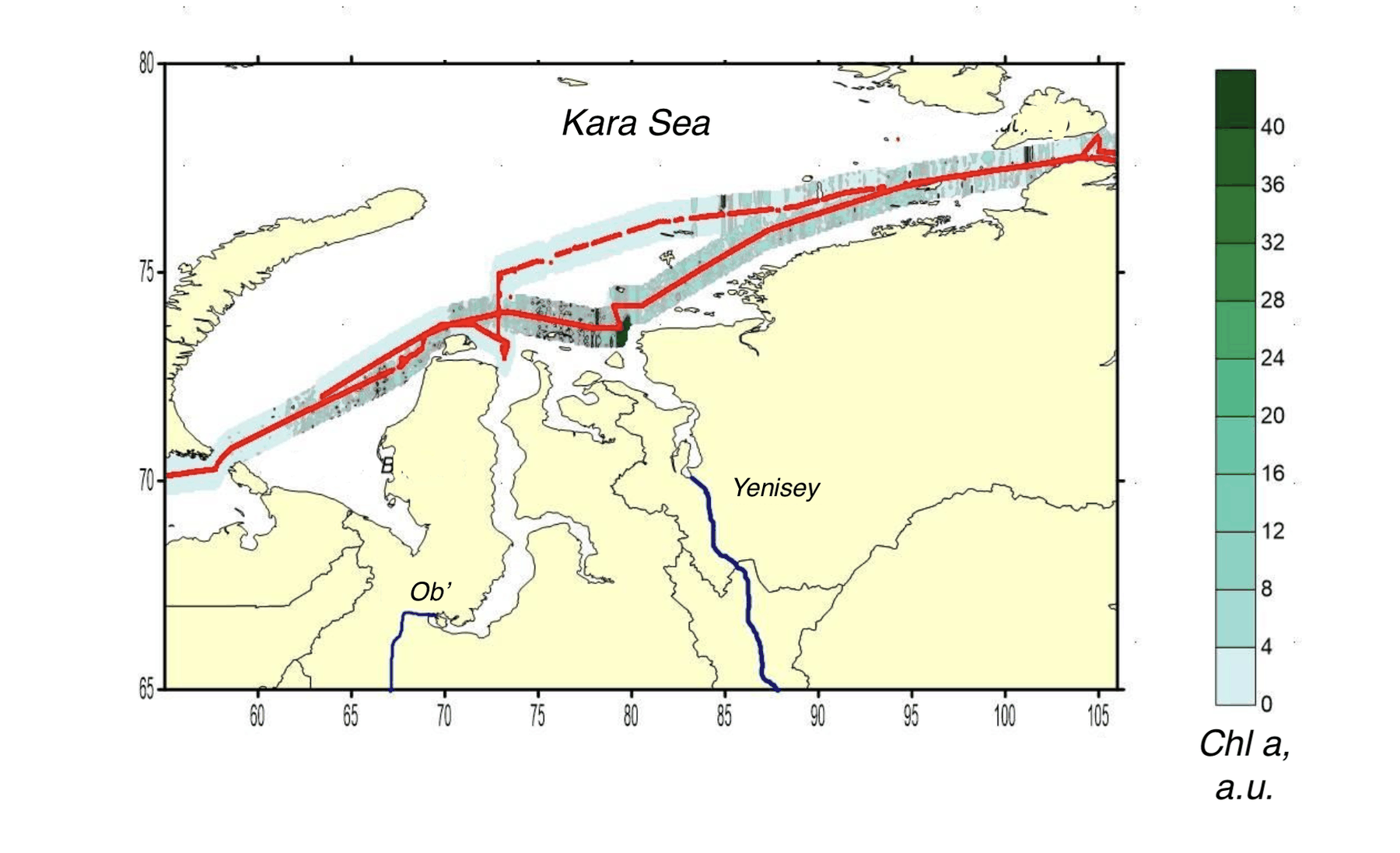
Interpolated chlorophyll a field mapped along the lidar track, Kara, Laptev, East Siberian seas, Kara Sea leg
Fig. 1Chlorophyll a
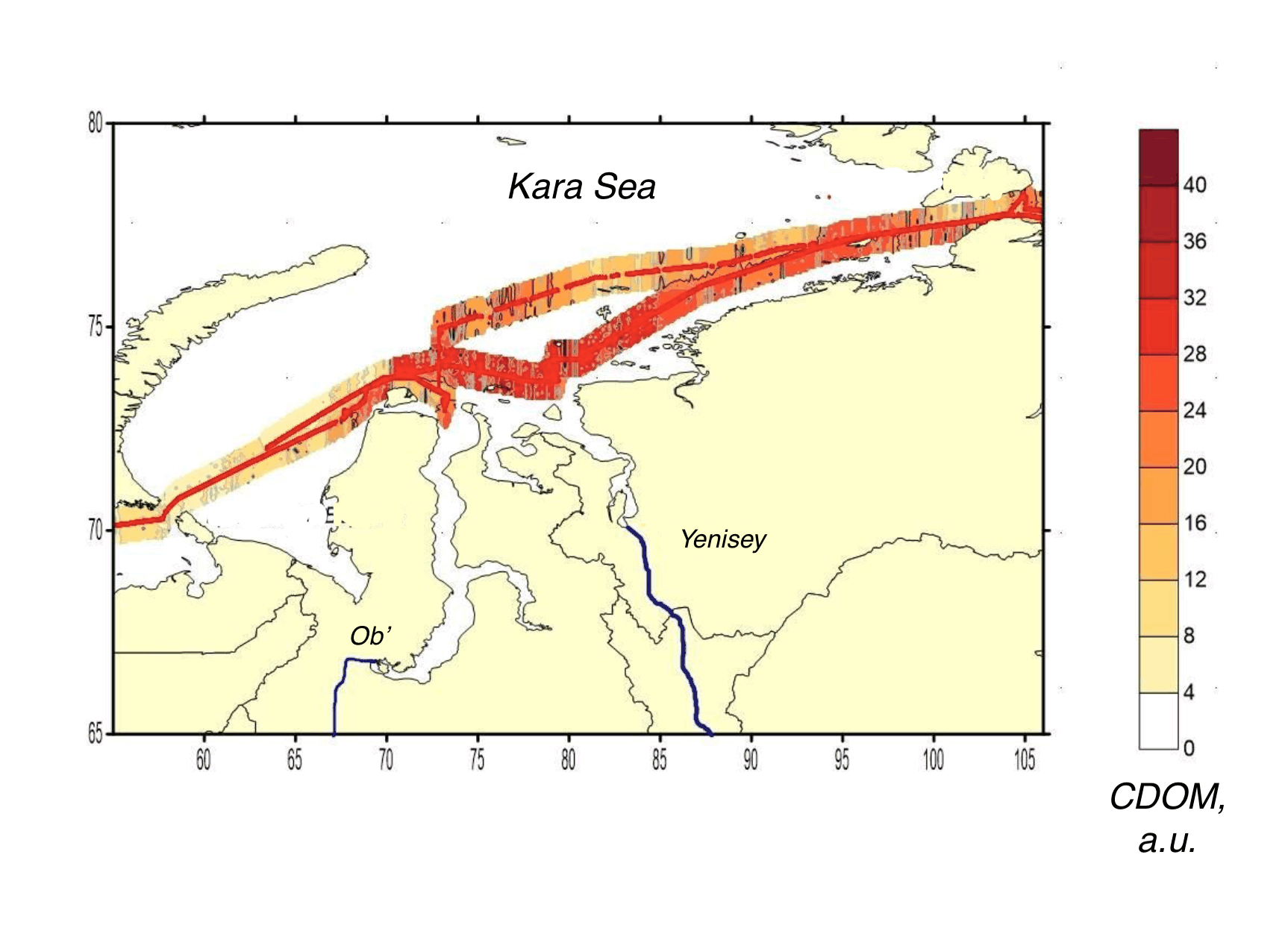
Interpolated CDOM field mapped along the lidar track, Kara, Laptev, East Siberian seas, Kara Sea leg
Fig. 2CDOM
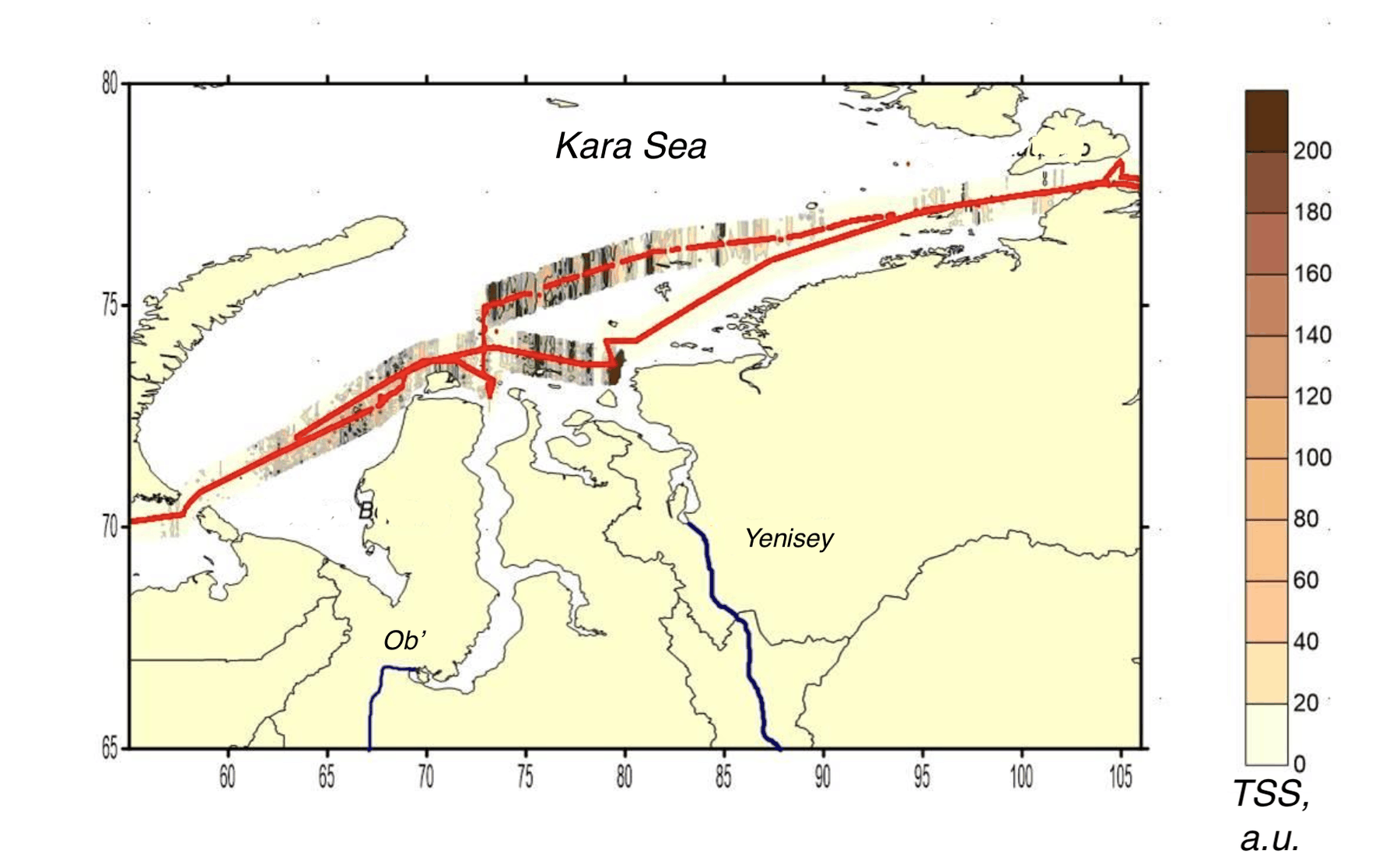
Interpolated total suspended matter field mapped along the lidar track, Kara, Laptev, East Siberian seas, Kara Sea leg
Fig. 3TSM

Laptev Sea leg

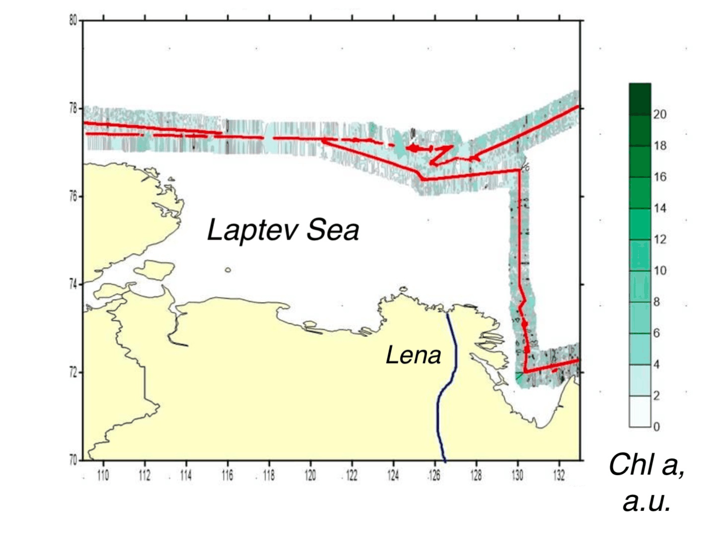
Interpolated chlorophyll a field mapped along the lidar track, Kara, Laptev, East Siberian seas, Laptev Sea leg
Fig. 4Chlorophyll a
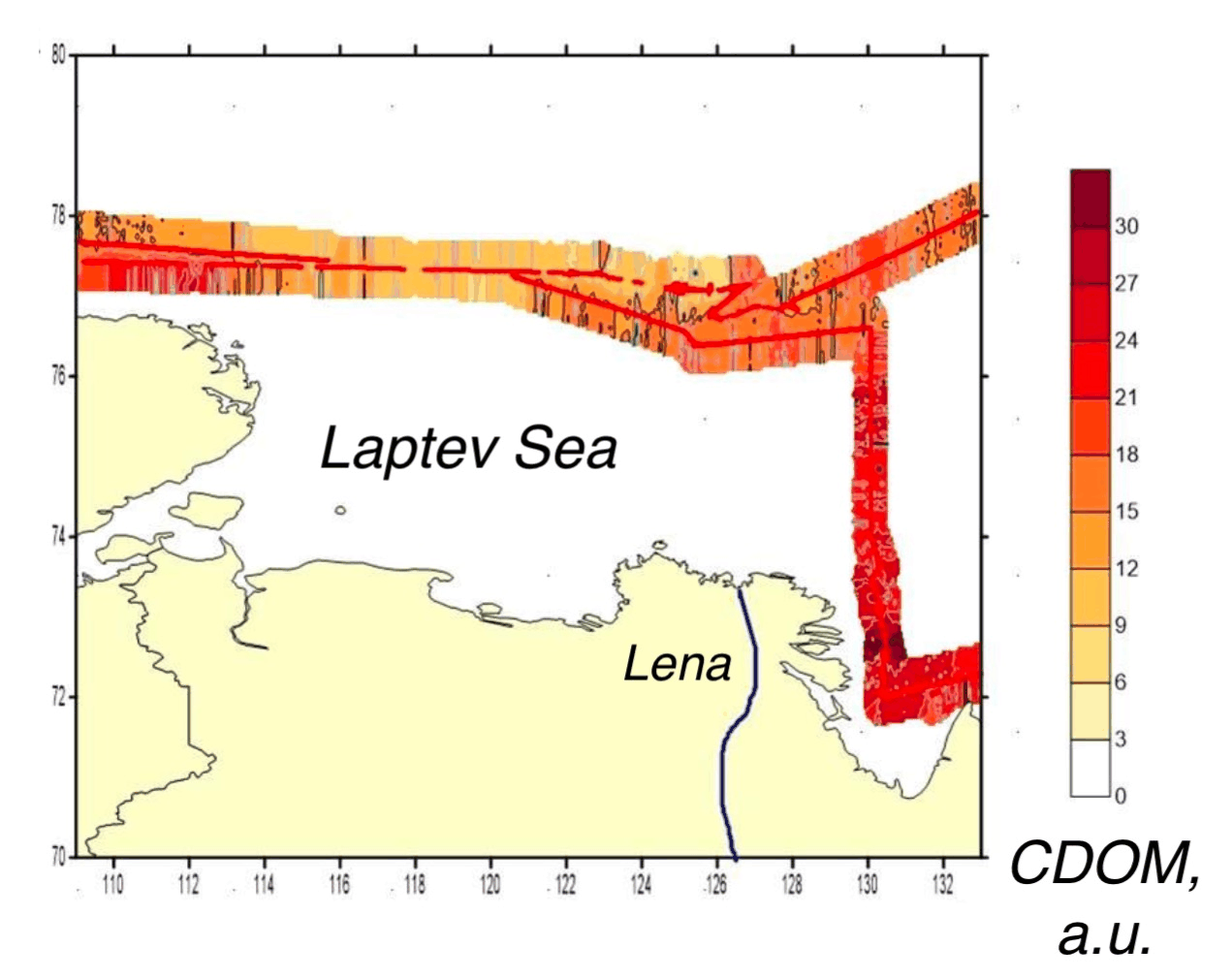
Interpolated CDOM field mapped along the lidar track, Kara, Laptev, East Siberian seas, Laptev Sea leg
Fig. 5CDOM
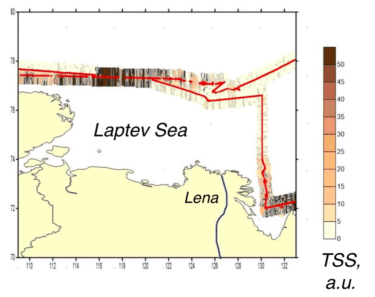
Interpolated total suspended matter field mapped along the lidar track, Kara, Laptev, East Siberian seas, Laptev Sea leg
Fig. 6TSM

East Siberian Sea leg

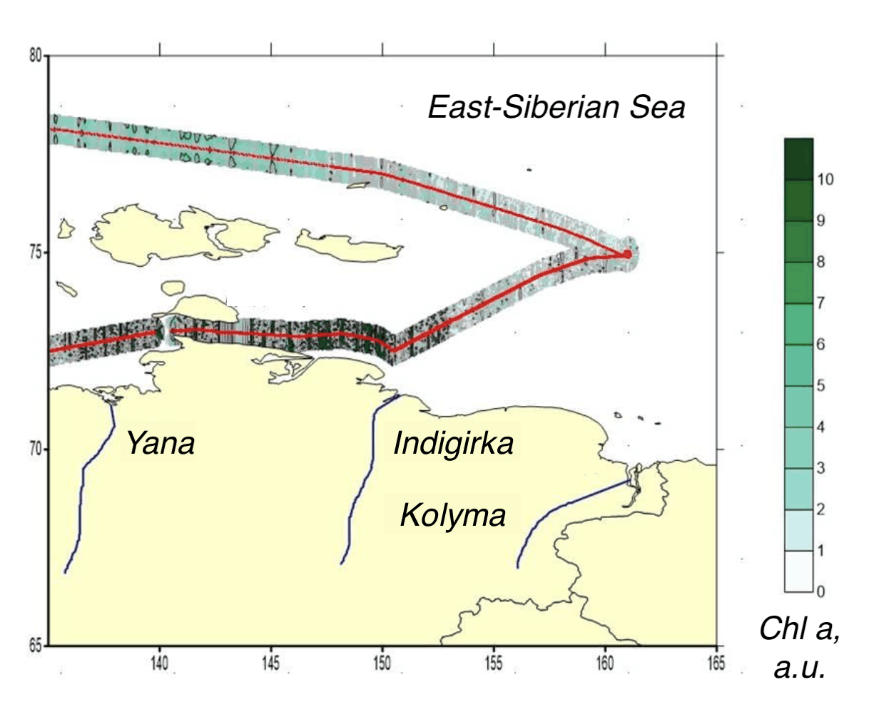
Interpolated chlorophyll a field mapped along the lidar track, Kara, Laptev, East Siberian seas, East Siberian Sea leg
Fig. 7Chlorophyll a
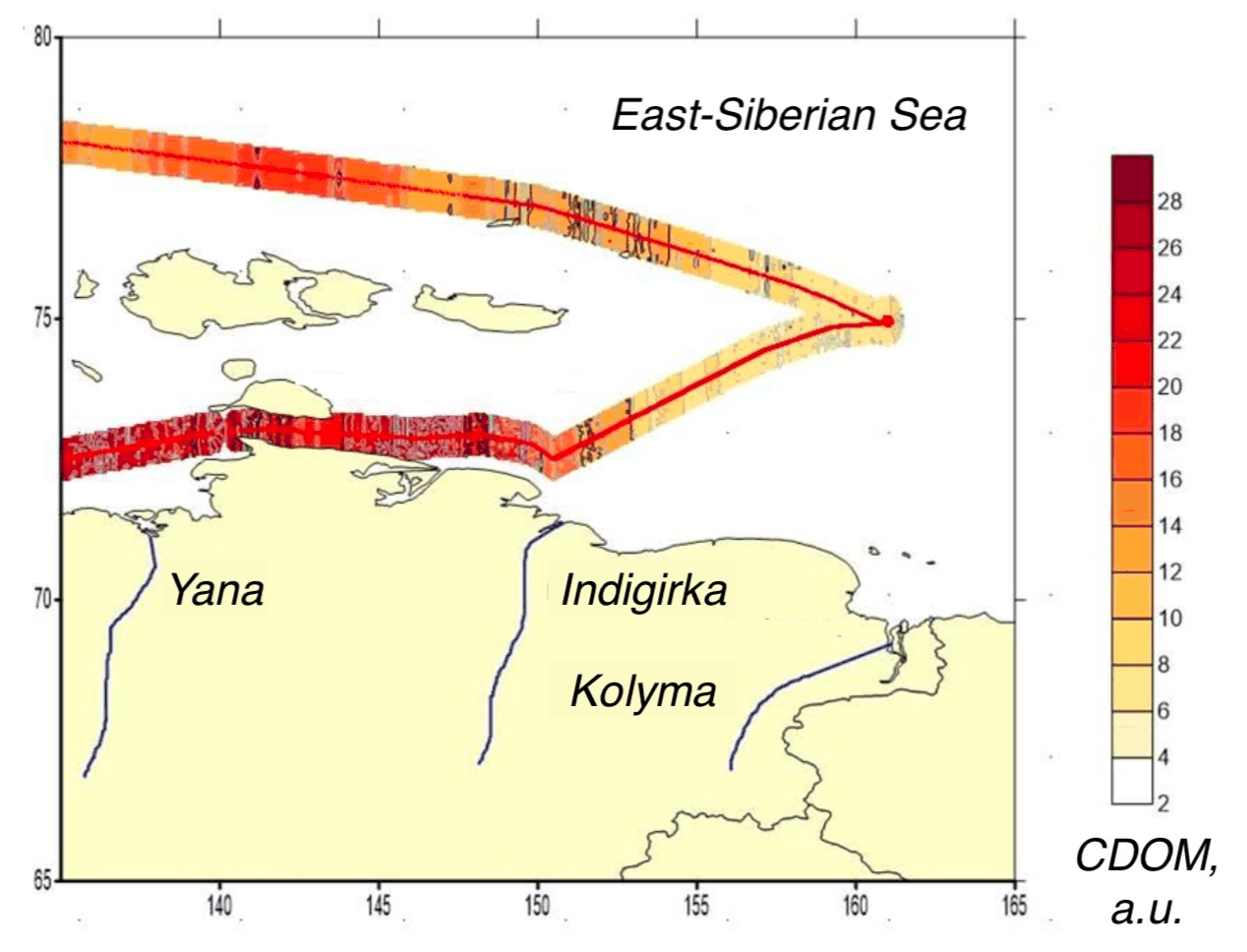
Interpolated CDOM field mapped along the lidar track, Kara, Laptev, East Siberian seas, East Siberian Sea leg
Fig. 8CDOM
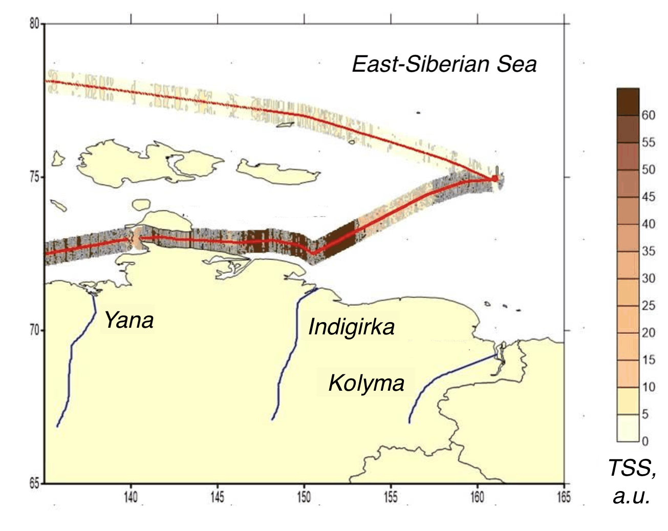
Interpolated total suspended matter field mapped along the lidar track, Kara, Laptev, East Siberian seas, East Siberian Sea leg
Fig. 9TSM

White Sea leg

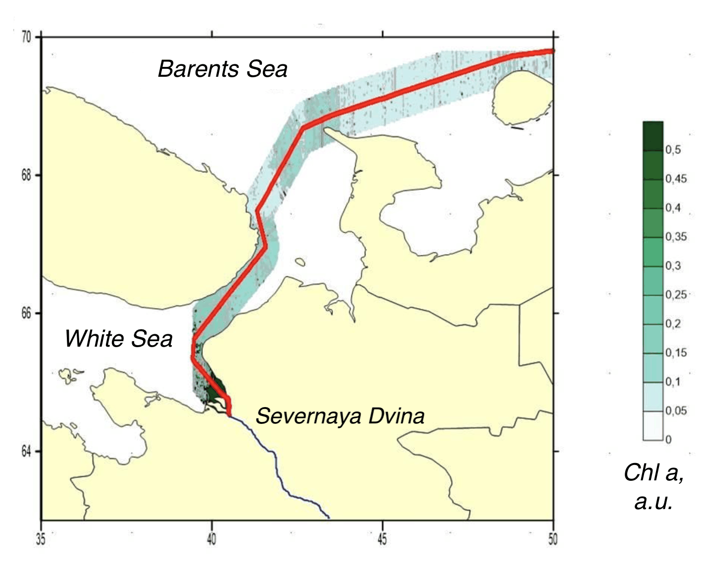
Interpolated chlorophyll a field mapped along the lidar track, Kara, Laptev, East Siberian seas, White Sea leg
Fig. 10Chlorophyll a
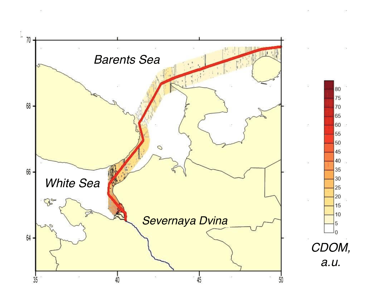
Interpolated CDOM field mapped along the lidar track, Kara, Laptev, East Siberian seas, White Sea leg
Fig. 11CDOM
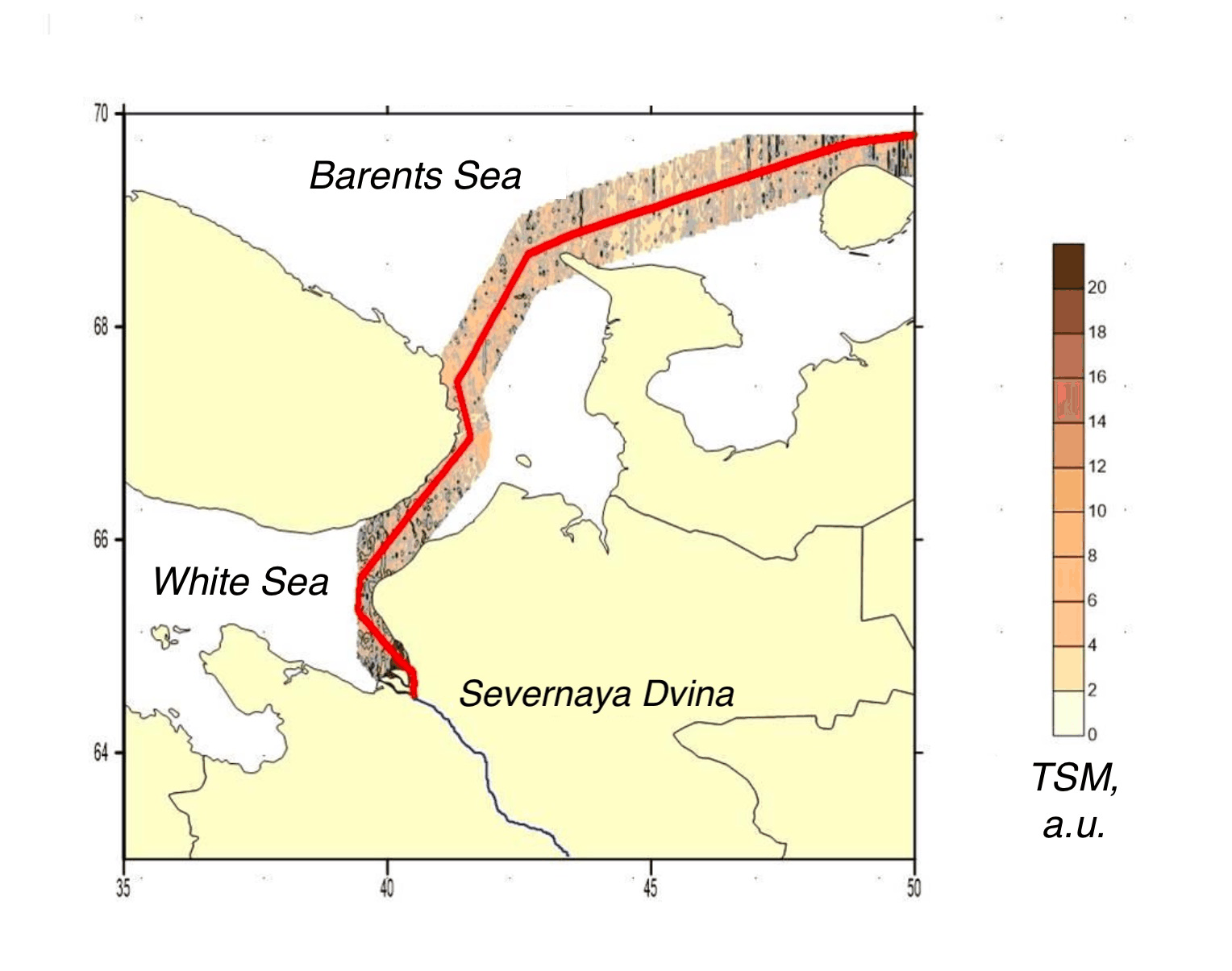
Interpolated total suspended matter field mapped along the lidar track, Kara, Laptev, East Siberian seas, White Sea leg
Fig. 12TSM
Kara to East Siberian SeaArctic Ocean
200 km
● Arctic 2020, Northern Sea Route, 2020-10-15 – 2020-10-29522,614 measurements IDW interpolation, 600 samples, track swath
Chl-a0.012.60µg/L
CDOM0.281.26a.u.
TSM0.3641.5mg/L

Fig. 13 Campaign measurement record. 522,614 lidar returns are plotted along the vessel track for Chl-a, CDOM, TSM. The field view applies inverse-distance weighting to the same observations; the shoreline is from Natural Earth.

During a six-week transit in autumn 2020, a ship-mounted LIF lidar operated along the Northern Sea Route from the Barents and Kara seas to the East Siberian Sea. The combined legs contain approximately 864,000 returns collected through late-season Arctic conditions.

The route crossed open Arctic waters and river-influenced shelf regions. Chlorophyll-a fell below 0.01 µg/L in the clearest legs, while CDOM and suspended matter increased in waters affected by major river discharge. The continuous transect records the transition between these optical regimes.